About the catchment Area
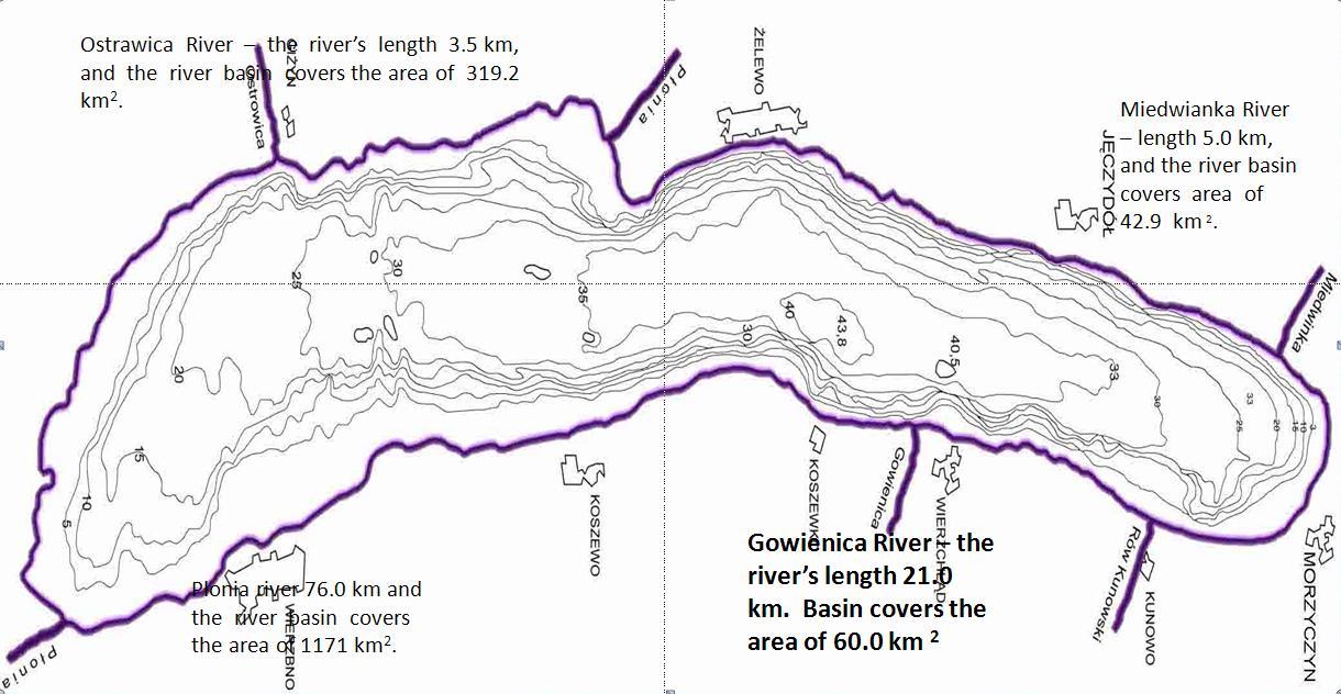
The Gowienica river catchment is located in the North-West Poland and has the surface of 63.65 km². The Gowienica river, which is 15,6 km long and of the average flow 0,15 m3/s being one of the Miedwie inlet, is mostly regulated.
Lake Miedwie, has been the water supply since 1976. Each day 100,000 m3 is produced to meet the needs of the Szczecin city agglomeration (population 330.000).
The catchment area is located in the Pleistocene ice-dammed lake, so the area is less morphologically diverse and most of the area is flat with little altitiude and the higher areas are located in the eastern part of the catchment area and within the southwest section of the watershed bounduary.
The average catchment height is 34 m, altitiude - 40 m, and the average slope is 5.01 m/km.
The average annual rainfall in the catchment area is about 500 mm, the average annual temperature is 7.5-8.0 °C, and the vegetation period lasts 210-230 days. Within the catchment area there are fertile soils formed of clay and water-based silt.
Links to the local action lab site and pages


Collaborative webtool Tutorial Video